IN THE BEGINNING Croton Heights was inhabited by "Indians, deer and wild turkeys." (According to Scharf: History of Westchester)
June 7, 1697: Sylvanus van Cortlandt received a grant of land in the New World from William III of England. It extended from Croton Point on the Hudson River to the present Connecticut border, and
northward ten miles. It included the present townships of Cortlandt, Yorktown, Somers, Poundridge and North and South Salem.
In 1734, upon his death, the land was divided among his heirs. His daughter Elizabeth received "Lot 4 of the Middle Ward" (covering Yorktown and Somers). She was married to Cortlandt Skinner.
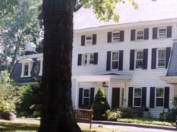
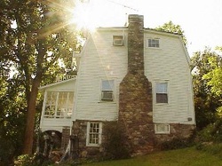
About 1744 J. Danfurt from Holland bought land and built the western part of the present Wilson house on Croton Heights Road. It was inherited by Richardson Davenport, who added the part east of the present hall, and ran it as the Davenport Inn during the Revolutionary War. It was said to have been a good one.
In May 1781 the Inn became the scene of a skirmish between American and British troops. At this time the British had invaded as far north as White Plains, and the American forces had retreated to northern Westchester, under General Washington. American soldiers had been stationed in the Inn to protect the Oblenus Ford over the Croton River, and they were betrayed to the British by a disgruntled Tory. About sunrise one day a British force under Col. Delancey crossed the ford and marched up the valley along Turkey Mountain (no road there then) and up the hill to the Inn.
During the subsequent engagement Major Flagg was killed, and Colonel Christopher Green, badly wounded, was carried out on a horse, on a lane leading to the old Pines Bridge, thrown off into the "whortleberry bushes," and left to die. Both officers were given a military funeral and buried, it is said, in a common grave, in the churchyard of the Presbyterian Church. A large stone monument marking the spot is easily visible to passers-by to this day.
In his report to Congress May 17, 1781 General Washington ends: "The loss of these two officers is to be regretted, especially the former (Colonel Greene) who has, upon several occasions, distinguished himself."
The account of a witness continued: "Between ten and twenty fell, in and around the house, and were afterward interred in one common pit or grave, in the northwest corner of the lot, under an ash tree."

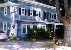
Later Jacob Carpenter married Davenport’s daughter and they lived in the Davenport house. Their daughter married Daniel K. Griffen, who built the farmhouse across the road, now the Croton Heights Inn. Croton Heights Inn. Legend has it that he built the wings on either side for his sons as they grew up and married. He was owner and resident of the property in 1881, when the Bolton History of Westchester was published.
An old calf-bound ledger, found in the attic of the Wilson house bears the inscription "Daniel K. Griffen & Sons, 1877," on the flyleaf. The latest entry in the same handwriting is September 19, 1892. The book then became the daybook of George C. Griffen. Entries run from September 1894 to November 31, 1902. Its pages, many of which are nearly illegible from flowers having been pressed therein, cast interesting sidelights on the local industry, and the prices and wages of the time.
An old calf-bound ledger, found in the attic of the Wilson house bears the inscription "Daniel K. Griffen & Sons, 1877," on the flyleaf. The latest entry in the same handwriting is September 19, 1892. The book then became the daybook of George C. Griffen. Entries run from September 1894 to November 31, 1902. Its pages, many of which are nearly illegible from flowers having been pressed therein, cast interesting sidelights on the local industry, and the prices and wages of the time.

What transpired between 1902 and 1924, when Mr. Wilson bought the 150-acre property (and named it Croton Heights) is left mostly to conjecture. At one time the Bowery Mission used the present Inn to house some of their old men. There were numbers on the walls in the attic to mark the beds. At one time there was a sawmill at the top of the ravine on the Bacon property, and the present Colonel Greene and Cliff roads lead to the site of the mill.
When Mr. Wilson bought the place, there were several buildings on it; besides the Wilson house and the present Inn there was an old barn and shed. They were re-built later as garages that burned in 1960. The old forge, now the Hobbs house: The old carriage house is said to have been lived in originally by the Danfurts and may be the oldest building of them all the is date uncertain. It is now the Nielsen-Ericksen house.
In 1925 Mr. Wilson and Warren C. Rowell bought an additional 100 acres to the East. The original deed states that the land was bought from Cortlandt Skinner and his wife Elizabeth by Zadoc Birdsall. The deed of sale is dated June 13, 1769. Richardson Davenport is one of the witnesses. The deed mentions a house and two barns. It is thought that the house mentioned is the present Waite house.Roads: The main road nearest the Inn in Revolutionary times was Pines Bridge Road (now Hanover Road) which ran from Crompond Road down to the Old Pines Bridge (east of the present structure). A rough lane led to it from the Inn. Just when the present Croton Heights Road (Cross Road in 1924) was built is not clear, but at one time it extended to the west up the hill through the Locke property (where there was once another Griffen farm) and down to the lake. There is still an exit to the present Route 129.
COMMITTEE ON CROTON HEIGHTS HISTORY Gertrude Eichler,Robert Nielsen, Edith M.Phelps,Chairman, Edited by Bill Lindsay Published by the Croton Heights Community Association.

THE CROTON HEIGHTS STONE WALL
Route 118 and Croton Heights Road
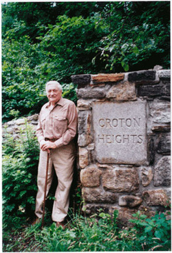
Construction: In late 1934 or early 1935 Chester Tompkins, a stone mason, was contracted by H.L. Wilson, one of the developers of Croton Heights, to build a stone wall to distinguish the entrance to Croton Heights. Chester designed the wall. The granite blocks in the two pillars, carved with the name of Croton Heights, were ordered from the quarry in Mohegan. Chester hired his brother, Wally, and Jim Wilson to work with him. The stones were laboriously brought up from the stream area below the road.
Because he was so busy during the other times of the year, Chester had to undertake building the wall in the winter. This meant a difficult problem with mixing the mortar and getting it to set properly. To deal with this he and the other masons kept a fire going and mixed the mortar with hot water. They also added a type of special salt to the mortar to help the setting process. Chester used a particular technique in constructing the walls in order to show off the size, shape and color of the stones. The mortar was not brought out to the face of the stones but, rather, set in. The wall took several months to complete.
As Croton Heights was developed, stone walls and paths were built throughout the area, including a path up from the train station which included a series of descending pools. Sadly, most have been destroyed over the years and the walls at the entrance stand as the only reminder of the stone work which once graced the entire area.
The walls not only provide a distinguishing entrance to the historic Croton Heights residential area but also serve as an example of the fine stonework which has been done in the area over the years.
